Skip to content
Bryan Conant Cartography
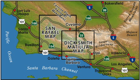
Trail Maps of Santa Barbara and Ventura County
Toggle Sidebar
Featured
Bryan Conant Mapping
Continue reading
→
Featured
Continue reading
→
Featured
Continue reading
→
May 26, 2014
June 9, 2015
Become Active and Volunteer
Continue reading
→
May 26, 2013
June 9, 2015
Product Endorsements
Continue reading
→
May 26, 2012
June 9, 2015
General Information
Continue reading
→
Privacy & Cookies: This site uses cookies. By continuing to use this website, you agree to their use.
To find out more, including how to control cookies, see here:
Cookie Policy
Subscribe
Subscribed
Bryan Conant Cartography
Sign me up
Already have a WordPress.com account?
Log in now.
Bryan Conant Cartography
Subscribe
Subscribed
Sign up
Log in
Report this content
View site in Reader
Manage subscriptions
Collapse this bar